
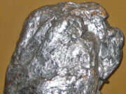
Molybdenite Mineral Guide: 7 Ultimate Properties of Molybdenum and Rhenium Ore
The Molybdenite mineral (molybdenum disulfide, MoS₂) is the primary global ore of molybdenum and the exclusive commercial host for rhenium (Re)—one of the rarest...
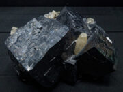
Galena Mineral Guide: 7 Ultimate Properties of Lead and Silver Ore
The Galena mineral (lead sulfide, PbS) is the primary global ore of lead and one of the most (important) geological reservoirs for primary silver...
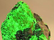
Willemite Mineral Guide: Properties, Fluorescence, and Non-Sulfide Zinc Ore
Willemite mineral (zinc silicate, Zn₂SiO₄) represents one of the most intriguing and economically vital non-sulfide zinc ores in economic geology. Containing theoretically 58.68% elemental...
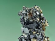
Sphalerite mineral
Sphalerite mineral (zinc sulfide, ZnS) represents the undisputed global cornerstone of zinc production. Accounting for more than 95% of primary zinc extracted worldwide, this...

Hydrothermal Ore Deposits: The Definitive Guide to Crustal Fluid Dynamics, Alteration Zoning, and Mineral...
1. Introduction: The Thermodynamic Engines of Global Metal Wealth
Hydrothermal ore deposits are mineral concentrations formed by the circulation of superheated, metal-bearing aqueous solutions (100°C...