Introduction: The Evolution of Underground Face Mapping
Traditionally, underground face mapping has been a time-consuming process, relying on manual sketches and tape measures. However, integrating mobile LiDAR technology into the daily mining cycle has revolutionized how we capture geological data. This workflow demonstrates how to transition from a raw point cloud captured at the active face to a fully integrated 3D vein wireframe.

Step 1: Rapid Data Acquisition at the Active Face
In narrow-vein underground operations, minimizing operational downtime is critical. Using LiDAR-equipped tablets or advanced mobile devices allows geologists to capture high-resolution point clouds of the active face in a matter of minutes. This digital approach captures the true geometry of the drift and the detailed texture of the ore mineralization, preserving the geological data long after the face has been blasted.
Step 2: Establishing Ground Control (Reference Points)
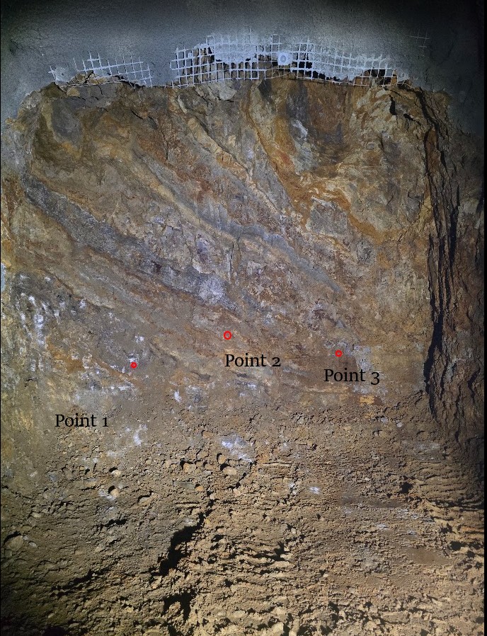
A highly detailed 3D scan is geologically useless if it is floating in local space. To ensure spatial accuracy, the surveying team establishes physical control points (targets) directly on the mining face or the drift walls before the scan is taken. These points are picked up using a total station to obtain their precise real-world XYZ coordinates. These surveyed targets serve as the crucial bridge between the digital scan and the mine’s global coordinate system.

Step 3: Georeferencing and Alignment in CloudCompare
Once the raw point cloud is acquired, it must be oriented to the mine grid. Open-source processing tools like CloudCompare are highly effective for this stage. By inputting the surveyed XYZ coordinates of our physical targets, we can accurately align, scale, and rotate the raw mesh. This georeferencing process transforms the isolated scan into spatially accurate geological data, ready for professional modeling environments.

Step 4: Spatial Integration in Leapfrog Geo
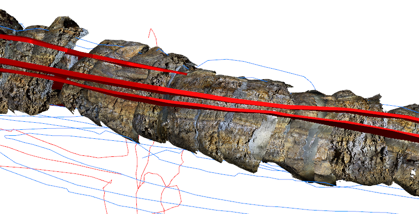
The fully georeferenced LiDAR mesh is then imported into 3D geological modeling software, such as Leapfrog Geo. At this stage, the digital face scan is validated against existing data sets. You can instantly visualize how the newly captured face aligns with historical underground as-builts, upcoming drift designs, and the existing drillhole database. The high-resolution texture allows for accurate visual confirmation of the ore grades and lithological boundaries right on the screen.

Step 5: Continuous 3D Vein Modeling and Wireframing
The true power of this workflow is realized when multiple daily face scans are stitched together. By continuously merging these sequential LiDAR meshes, you generate a highly detailed, permanent digital twin of the underground gallery.
Using these continuous scans, resource geologists can digitize the exact hanging wall and footwall contacts directly from the structural textures visible on the mesh. This dynamic updating process results in a highly accurate, real-time 3D wireframe of the ore vein, significantly improving grade control and short-term mine planning.