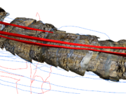
Drones have become an indispensable tool in our exploration arsenal. I’ve found that using hardware like the DJI Mavic 2 Pro is highly effective for coordinating the transmission of coordinates, taking high-res photographs of gallery sites, and planning upcoming drilling well locations in rugged terrains.
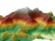
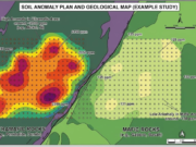
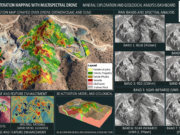
But the real magic happens when we bring that data back to the desk. Processing the drone imagery into high-resolution orthomosaics and DEMs (Digital Elevation Models), and then pulling them directly into QGIS (or even legacy setups like MapInfo Pro) is a game-changer. It allows us to precisely digitize structural lineaments and accurately overlay our 100x100m soil geochemistry grids right on top of the fresh topographical data.
However, maintaining consistent photogrammetry overlap in areas with extreme topographical relief can be tricky, which sometimes distorts the final DEM generation. What flight planning software or specific QGIS workflows are you guys using to process and handle these massive drone datasets without crashing your systems?


.